
- SAP Community
- Products and Technology
- Technology
- Technology Blogs by SAP
- ASCII art map of the World: the Web Mercator proje...
Technology Blogs by SAP
Learn how to extend and personalize SAP applications. Follow the SAP technology blog for insights into SAP BTP, ABAP, SAP Analytics Cloud, SAP HANA, and more.
Turn on suggestions
Auto-suggest helps you quickly narrow down your search results by suggesting possible matches as you type.
Showing results for
Developer Advocate
Options
- Subscribe to RSS Feed
- Mark as New
- Mark as Read
- Bookmark
- Subscribe
- Printer Friendly Page
- Report Inappropriate Content
04-04-2018
5:48 PM
This week I decided to go back to ASCII art maps calculated with SAP HANA. It is another #GeospatialTuesday entry, and - although published on Wednesday - I still can prove it was done on Tuesday: https://twitter.com/Sygyzmundovych/status/981287806252314624 😉
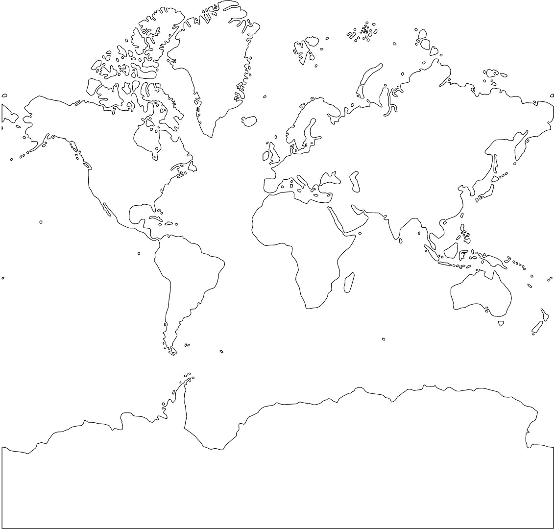
So, to the point. Last year I published two posts on generating ASCII map with an equirectangular projection and with a polar azimuthal equidistant projection. Looking more closely on the first one, you could see it looks different from the maps you see regularly on the web, like OpenStreetMap, Google Maps, Bing Map etc. That's because all of them are using different map projection, called Mercator, or - to be more precise - Web Mercator projection with Spatial Reference System id

The good news: in my previous post I showed how to create SRS
Spatial Reference Systems 3857 and 1000004326 have some differences, as you can see.

Web Mercator's unit of measure is not a planar degree, but a meter, and therefore coordinates are different. Additionally Web Mercator is limited to bounds - 85°S to 85°N. I would probably need a separate post to discuss all these in more details, but for the moment let's take this as a given.
It means that previously used SQLScript procedure must be updated to replace some hard-coded values with parameters now. Here it is.
Let's create table with a single geometry of all land polygons.
SVG shape looks properly.
Let's try running our procedure then!
Just what we needed! Ok, I did cut a few lines at the bottom, so Antarctica is somewhat smaller on the screenshot.

But does it still work for equirectangular projection, e.g. for Australian case?

‘Till next time,
-Vitaliy, aka @Sygyzmundovych
So, to the point. Last year I published two posts on generating ASCII map with an equirectangular projection and with a polar azimuthal equidistant projection. Looking more closely on the first one, you could see it looks different from the maps you see regularly on the web, like OpenStreetMap, Google Maps, Bing Map etc. That's because all of them are using different map projection, called Mercator, or - to be more precise - Web Mercator projection with Spatial Reference System id
3857.The good news: in my previous post I showed how to create SRS
3857, how to download files from OpenStreetMap-derived data and how to import them to SAP HANA using this SRS. But today we will use land polygons files (not coastlines files), so that we can build ASCII map.Spatial Reference Systems 3857 and 1000004326 have some differences, as you can see.
select srs_id, srs_name, axis_order, min_x, max_x, min_y, max_y, linear_unit_of_measure, round_earth

from "PUBLIC"."ST_SPATIAL_REFERENCE_SYSTEMS"

where srs_id in (3857, 1000004326);
Web Mercator's unit of measure is not a planar degree, but a meter, and therefore coordinates are different. Additionally Web Mercator is limited to bounds - 85°S to 85°N. I would probably need a separate post to discuss all these in more details, but for the moment let's take this as a given.
It means that previously used SQLScript procedure must be updated to replace some hard-coded values with parameters now. Here it is.
CREATE TYPE "NATURAL_EARTH"."TT_SHAPES" AS TABLE ( "SHAPE" ST_GEOMETRY );


CREATE PROCEDURE "NATURAL_EARTH"."ASCII_MAP_PLANAR_FLEX"

(IN input_shape "NATURAL_EARTH"."TT_SHAPES", IN resolution INT,

IN srs INT DEFAULT 1000004326, IN primeMeridian FLOAT DEFAULT 0.0, IN northUp INT DEFAULT 1)

 LANGUAGE SQLSCRIPT AS

 loopLon, loopLat, calcLon, calcLat FLOAT;

 minX, maxX, minY, maxY, totalX FLOAT;

 meridianShift INTEGER;

 stringSurface, pointSurface STRING;

 BEGIN

 	select "MIN_X" into minX from "PUBLIC"."ST_SPATIAL_REFERENCE_SYSTEMS" where srs_id = :srs;

 	select "MAX_X" into maxX from "PUBLIC"."ST_SPATIAL_REFERENCE_SYSTEMS" where srs_id = :srs;

 	select "MIN_Y" into minY from "PUBLIC"."ST_SPATIAL_REFERENCE_SYSTEMS" where srs_id = :srs;

 	select "MAX_Y" into maxY from "PUBLIC"."ST_SPATIAL_REFERENCE_SYSTEMS" where srs_id = :srs;

	totalX = :maxX - :minX;


    IF northUp <> 1 THEN northUp := -1; END IF;

    IF resolution > 1000 THEN resolution := 1000; END IF;

    IF resolution < 20 THEN resolution := 20; END IF;

    IF primeMeridian < minX OR primeMeridian > maxX THEN primeMeridian := 0.0; END IF;

    loopLat := :maxY;

    WHILE loopLat>= :minY DO

        loopLon := :minX;

        calcLat := loopLat * northUp;

        stringSurface := '';

        WHILE loopLon<= :maxX DO

            calcLon := loopLon * northUp;

            select new st_point('POINT ('||:calcLon||' '||:calcLat||')', :srs).ST_CoveredBy("SHAPE") into pointSurface

            FROM :input_shape where "SHAPE".ST_SRID() = :srs;

            stringSurface := concat (stringSurface, pointSurface);

            loopLon := loopLon+totalX/resolution;

        END WHILE;

        meridianShift := mod(primeMeridian*northUp +totalX, totalX) * resolution/totalX;

        stringSurface := concat (right(stringSurface, resolution-meridianShift), left(stringSurface, meridianShift+1));

        INSERT INTO "NATURAL_EARTH"."DRAW_EARTH" VALUES (:calcLat, :stringSurface);

        loopLat := loopLat-totalX/resolution;

    END WHILE;

 END;
Let's create table with a single geometry of all land polygons.
CREATE COLUMN TABLE "TESTSGEO"."EARTH3857" ("SHAPE" ST_GEOMETRY(3857) ) ;

INSERT INTO "TESTSGEO"."EARTH3857" SELECT ST_UnionAggr("SHAPE") FROM "TESTSGEO"."land_polygons_z1";


SELECT "SHAPE".st_asSVG() FROM "TESTSGEO"."EARTH3857";
SVG shape looks properly.
Let's try running our procedure then!
truncate table "NATURAL_EARTH"."DRAW_EARTH";


CALL "NATURAL_EARTH"."ASCII_MAP_PLANAR_FLEX"(

	INPUT_SHAPE => "TESTSGEO"."EARTH3857",

	RESOLUTION => 120,

	SRS => 3857

);


SELECT replace(replace("SSTRING", '0', ' '), '1', '*') as "ASCIIMAP" FROM "NATURAL_EARTH"."DRAW_EARTH";
Just what we needed! Ok, I did cut a few lines at the bottom, so Antarctica is somewhat smaller on the screenshot.
But does it still work for equirectangular projection, e.g. for Australian case?
TRUNCATE TABLE "NATURAL_EARTH"."DRAW_EARTH";


CALL "NATURAL_EARTH"."ASCII_MAP_PLANAR_FLEX"(

	INPUT_SHAPE => "NATURAL_EARTH"."NE_EARTH",

	RESOLUTION => 180,

	SRS => 1000004326,

	primeMeridian => 158,

	northUp => 0

);


SELECT replace(replace("SSTRING", '0', ' '), '1', '*') as "ASCIIMAP" FROM "NATURAL_EARTH"."DRAW_EARTH";
‘Till next time,
-Vitaliy, aka @Sygyzmundovych
- SAP Managed Tags:
- SQL,
- SAP HANA,
- SAP HANA, express edition,
- SAP HANA multi-model processing,
- SAP HANA Spatial,
- Big Data
Labels:
You must be a registered user to add a comment. If you've already registered, sign in. Otherwise, register and sign in.
Labels in this area
-
ABAP CDS Views - CDC (Change Data Capture)
2 -
AI
1 -
Analyze Workload Data
1 -
BTP
1 -
Business and IT Integration
2 -
Business application stu
1 -
Business Technology Platform
1 -
Business Trends
1,658 -
Business Trends
93 -
CAP
1 -
cf
1 -
Cloud Foundry
1 -
Confluent
1 -
Customer COE Basics and Fundamentals
1 -
Customer COE Latest and Greatest
3 -
Customer Data Browser app
1 -
Data Analysis Tool
1 -
data migration
1 -
data transfer
1 -
Datasphere
2 -
Event Information
1,400 -
Event Information
67 -
Expert
1 -
Expert Insights
177 -
Expert Insights
301 -
General
1 -
Google cloud
1 -
Google Next'24
1 -
GraphQL
1 -
Kafka
1 -
Life at SAP
780 -
Life at SAP
13 -
Migrate your Data App
1 -
MTA
1 -
Network Performance Analysis
1 -
NodeJS
1 -
PDF
1 -
POC
1 -
Product Updates
4,577 -
Product Updates
346 -
Replication Flow
1 -
REST API
1 -
RisewithSAP
1 -
SAP BTP
1 -
SAP BTP Cloud Foundry
1 -
SAP Cloud ALM
1 -
SAP Cloud Application Programming Model
1 -
SAP Datasphere
2 -
SAP S4HANA Cloud
1 -
SAP S4HANA Migration Cockpit
1 -
Technology Updates
6,873 -
Technology Updates
429 -
Workload Fluctuations
1
Related Content
- Develop and deploy a HTML (Angular/Vue/React) app on SAP BTP access S/4 OP, Part III in Technology Blogs by SAP
- SAP CAP(Cloud Application Programming)开发框架概述 in Technology Blogs by SAP
- XSA Blog Series - Virtual modeling in Technology Blogs by Members
- Sap Datasphere Data Flow Series – Script Operator Part 1 in Technology Blogs by Members
- Unlocking Data Value #2: Data Integration and Modeling with SAP Datasphere in Technology Blogs by SAP
Top kudoed authors
| User | Count |
|---|---|
| 34 | |
| 17 | |
| 16 | |
| 15 | |
| 11 | |
| 9 | |
| 8 | |
| 8 | |
| 8 | |
| 7 |