Esri which is a mapping software helps you understand and visualize data to make decisions based on the insights from geo-charts.
With Esri Maps integrated in SAP Lumira you can now enable your geo-business data with intuitive mapping and analytical tools. You will quickly discover new patterns in the geo charts within Lumira and effortlessly share your insights across the organization for greater collaboration.
For more information on obtaining an Esri License and credentials please visit : http://www.esri.com/software/arcgis/arcgisonline
To set your Esri Account in SAP Lumira enter your Esri account details under the Preferences :

Below I have created a simple Geo Chart highlighting the Sales Revenue across different locations :

The type of chart can be changed to an Esri chart by selecting by selecting the "Geo Map" chart type :

This option opens up an Esri Map within Lumira. Following is an analysis of Sales Revenue in different regions using Esri.

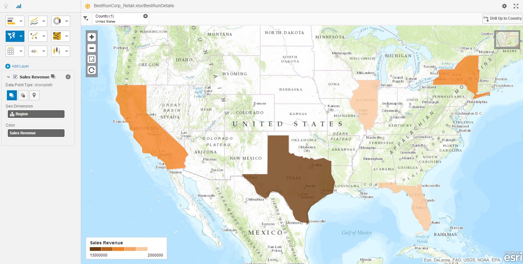
Now, you can drill - down in United States to see the Sales Revenue Distribution within a specific location. By Double clicking you can zoom into a location. A Drill-Down operation on a specific country - US has been applied.

A drill - down view of different states is available here which shows the Sales Revenue in the US states with Sales revenue being the highest in Texas, followed by California, New York, Illinois and Florida.
One of the nice features of Esri that is not present in native geo implementation is the concept of layers.

For example I can have a chloropleth map and then do a bubble plot on top of that. See below :

Here I have used the Marker capability to point out and mark the different geographic regions.

Another feature (also not present in the native geo offering) is the ability to show different map views: topographic, street, satellite, gray.

This can be now published to SAP Lumira Server/ Cloud. It would be very easy to modify this to include Lumira Server / Cloud by calling out that Esri credentials are supplied the first time you generate map (they can then be cached to avoid future re-prompts).
Here is a view of the Esri chart published on Lumira Cloud :

Please note that Esri maps capability is available in the SAP Lumira 1.17 - Standard Edition.
