Busy S4 release, lots of topics. Today, I would like to show how the usage of Geographical Information Services (GIS) can be made country specific in S/4 2020.
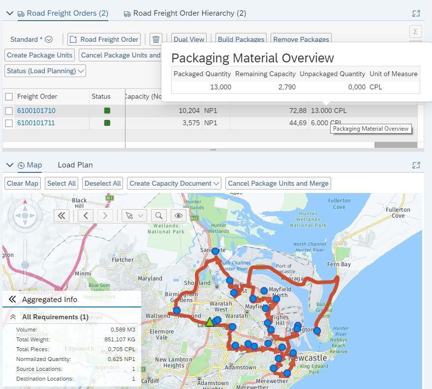
Transportation Planning Scenario based on high quality GIS data including map visualization
First of all, what is this about? S/4 master data elements like locations can be enriched with geo-coordinates when having address information defined. These geo-coordinates can then be used to determine real-street distances and durations being a qualified input for transportation planning processes. Also, stage like documents can be displayed on geo-maps using SAP Visual Business integrated into single document transactions, worklists, the Transportation Cockpit, or the Transportation Network Cockpit. When doing so, they can either be shown using straight line arrows, or better real street geo-routes. So we have 4 functions:
- Geo-Coding (MKS07)
- Distance and Duration Determination (MKS46)
- Geo-Routing (MKS23)
- Map Display (MKS29)
All of those function require external services, when quality data is required. You can find details in
MKS33.
The customer requirement is pretty simple: For global acting companies, it can be required to use different vendors or products to deliver those GIS depending on the country the scenario is located. This can be forced by data quality (the globally used vendor does not have sufficient service quality in specific countries) or legal requirements (the usage of specific vendors is forbidden in some countries).
So far, the connection to the external GIS was a custom project as no SAP component existed handling this (for Transportation Management, this was out of scope as it is out of our expert domain). So country specific requirements could be implemented in the external service connection.
But with the rise of the SAP Cloud Platform Spatial Service and the standard connection being available (
MKS86), this has changed and requires more standard options when configuring the usage of GIS.
I will explain a scenario where globally the SCP Spatial Services shall be used, but for North America a deviating vendor shall be configured.
To ease the maintenance, first of all countries can be grouped into GIS Zones (this was available before). So I setup a GIS Zone for North America.

I assign the US and Canada to it:

In the configuration of the Geo-Coding ('Define Geo-Coding Levels'), I can now differentiate the used GIS:
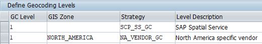
When now a location is created or the address adjusted, the system will check based on the mandatory country field which GIS Zone is valid and find the right service to use.
In the activity 'Define Strategy for Distance and Duration Determination and Georouting', I can do the same for the two other backend services:
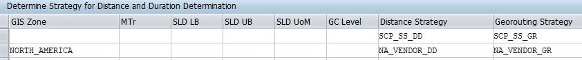
Note that the more specific key attributes are of course also supported (Means of Transport specific, GC Level specific).
When both the start and the destination of a Distance and Duration Determination or a Geo-Routing request fall into the same GIS Zone, the service is picked up. In case they fall into different GIS Zones, the default is used.
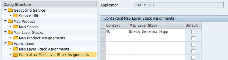
The last remaining configuration is the geo-map content (MKS). Under 'Define Layouts for Geographical Map' there is a new field 'Context Country' on the layout header. Here you can enter a generic value (for example the name of your GIS Zone, even though it is called context country). This field points to the SAP Visual Business customizing in activity 'Maintain Application Definitions'. There a new sub-node 'Contextual Map Layer Stack Assignment' per Geo-Map application is possible.
For the availability of the feature you can check the following notes: 2888335, 2909110, 2908412, 2907735
