What is SAP GEO.e?
SAP GEO.e stands for the geographical enablement of SAP. With GEO.e it is now possible to add also spatial attributes to almost any SAP object. This spatial attribute can be either a point, a line or a polygon. GEO.e works perfectly with SAP Linear Asset Management (SAP LAM).
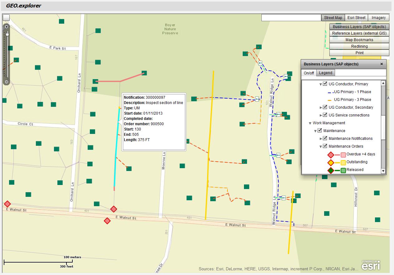
It is possible to create, update, show and report on assets, notifications or work orders from a map to support business processes in SAP EAM or SAP Utilities.
Benefits of GEO.e
With GEO.e the need to exchange data with an existing GIS (Geographical Information System) is very limited since the geo-spatial information sits in the SAP environment where all business processes are executed.
GEO.e can be implemented very quickly with much less costs an effort compared to a ‘traditional’ GIS integration project.
SAP GEO.e is an Engineered Service provided by SAP Consulting.
GEO.e Session at the SAP Conference for Utilities for the MENA region in Mannheim
We will give a brief overview about the capabilities of GEO.e at the Microforum on Day 2 (April 10, 2014 at 12:30pm). Also a live demo and some use cases from customer projects will be provided.
