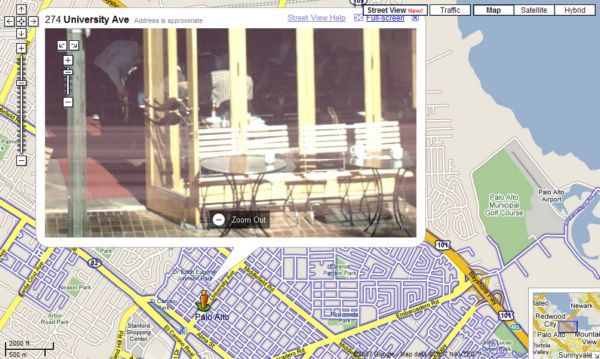
At Where 2.0 in San Jose Google today announced a new feature, which adds another level of data (and fun) to Google Maps. For all of you who have done mashups between SAP data and Google Maps there is more to play with... Here is how it works. At the view buttons at the top right of the map you now have a new one, "Street View". Once you choose it (and you are zoomed in close enough) you see the streets that the images are available for (today just for a few cities in the US, I am sure it will rapidly increase) in blue: As you zoom in you can see the streets in more detail, and you can place a person icon for the street view: Click on a street to place the person and to open the street view bubble. It shows you the image and the line in the middle helping to you orient yourself what you are looking at. Also note that the person icon now has an arrow showing which direction you are looking at (here downtown Palo Alto): With the up/down arrow keys you move forward and backward along the line, and with the left/right arrow keys you get a seamless 360 degree view of the location... this is A9 on steroids! So looking to the right you get one of my favourite breakfast spots: With the + and - keys you can zoom in in a few steps: You can also select "Full Screen" in the bubble to enlarge the image: If you are at a point where one or more streets cross (like here in the San Francisco Marina district) you get all other street centerlines and can "drive" onto another street: And here is a fun "application" of this. Say you know you will visit the San Francisco Embarcadero you can drive up and down and see where they have parking... ... and you can actually zoom in to see the signs giving you the price 😉